

Singapore’s First Polder at Pulau Tekong Adds 800 Hectares of Land

tekong

Singapore has reclaimed about 800 hectares of land – the size of about two Toa Payoh towns – at the north-western tip of Pulau Tekong, the HDB announced in a joint statement with the PUB. 

The reclaimed land will be used for military training purposes. This will free up space on the mainland for other uses, such as developing new homes and amenities for Singaporeans.

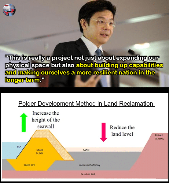
The project was first announced by PM Lawrence Wong in 2016 when he was the National Development Minister. 

5July2019(2)
PM Lawrence Wong in 2016 when he was Minister for National Development

PM Wong visited the site on September 8 to view the polder. 

The completion of main construction works for the polder via the empoldering method marks the first time Singapore has reclaimed land below the mean sea level.

Compared to the traditional land reclamation method of infilling with sand to reclaim land above sea level, the empoldering method uses less sand. This has resulted in close to 50 percent of savings in sand used for the reclamation.

v2
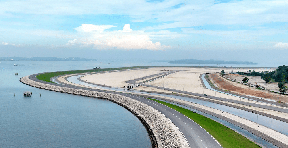
A 10km-long coastal dike protecting the low-lying polder land from the sea (Credit: HDB)

A Robust Coastal Dyke

The coastal dike is a 10-kilometre long structure that runs along the perimeter of the polder and protects the low-lying polder land from the sea. It stands at up to six metres above mean sea level at its highest point, and allows for the polder land to lie about 1.2 metres below mean sea level.

The coastal dike height can be raised if needed, to adapt to future increase in sea levels.

The coastal dike was the first key infrastructure to be completed, as it was necessary to fully enclose the area being reclaimed to manage water levels within the polder.

A road that runs along the entire crest of the coastal dike has also been built to facilitate maintenance works. This road, together with another 21 kilometres of roads constructed within the polder land, allow vehicles to safely navigate the polder.

Screenshot 2025 09 08 203824
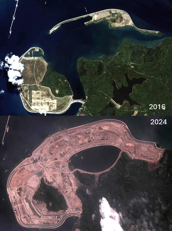
Polder area at Pulau Tekong in 2016 (top photo: KARI (2016) and later in 2024 (bottom photo; credit: ST Engineering Geo-Insights).

A Comprehensive Water Management System

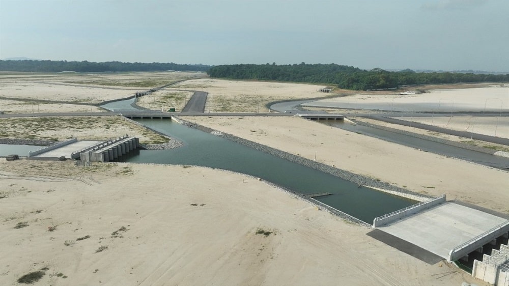
The polder’s water management system comprises a stormwater collection pond, two pumping stations, and an extensive 45 kilometres of drainage network with more than 30 water control, inlet and outlet structures with gates to manage rainfall.

v3
Drainage network on the polder (Credit: HDB) During dry weather, water is recirculated by pumping water from the stormwater collection pond to the polder drainage network to prevent stagnation.

Stormwater Collection Pond

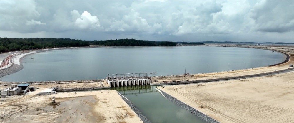
When it rains, runoff within the polder and the Pulau Tekong catchment area is conveyed to the 116-hectare stormwater collection pond to mitigate flooding within the polder.

When the water level in the stormwater collection pond reaches a pre-set operating level, excess water is channelled to the Drainage Pumping Station to be pumped out into the sea. 

v4
The stormwater collection pond is designed to hold up to 5 million cubic metres of water, the equivalent of 2,000 Olympic-sized swimming pools. (Credit: HDB)
Screenshot 2025 09 08 210216
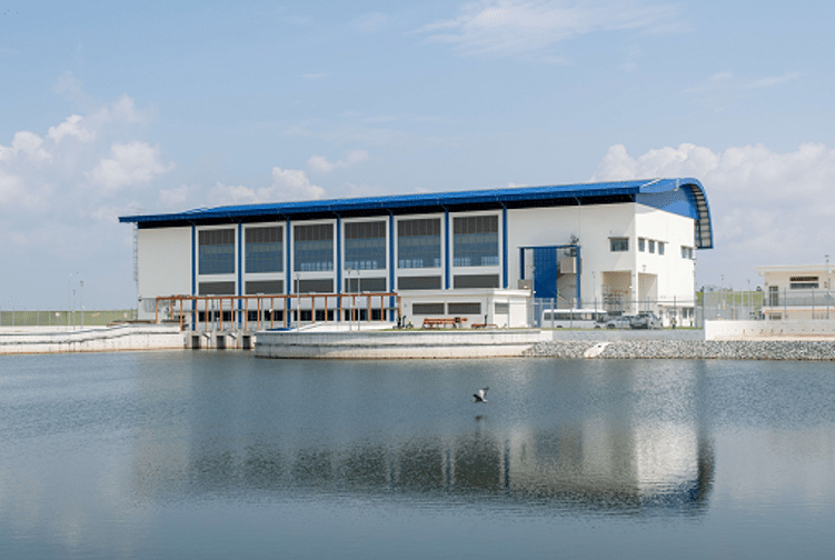
The Central Pumping Station located next to the stormwater collection pond circulates water in the drains to ensure good water quality. (Credit: HDB)
Screenshot 2025 09 08 210408
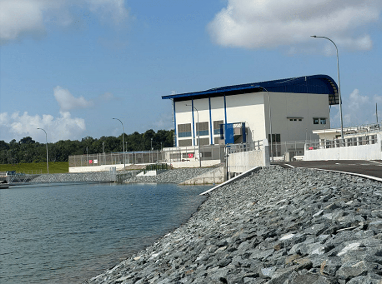
The Drainage Pumping Station located next to the coastal dike helps to pump excess rainwater into the sea when the stormwater collection pond is full. (Credit: HDB)

In designing the coastal dike and its safety provisions, HDB and PUB drew on the deep experience of the Netherlands, which has the world’s highest standards for dike safety, to ensure the long-term viability and safety of the polder land.

Source: Joint statement by HDB and PUB

Share:

On Key

Related Posts